![TAK logo]()
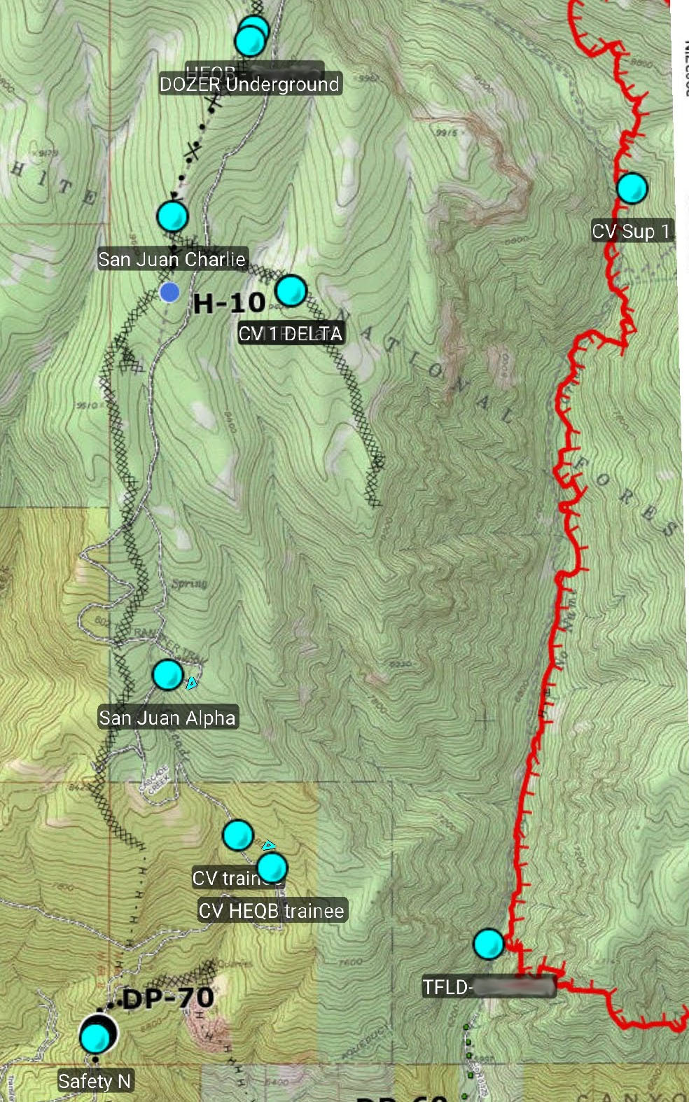
First responders have many options for gaining and maintaining situational awareness at a strategic level when responding to disasters. Computer aided dispatch systems and dashboard-style maps can provide information across a jurisdiction or the entire country on emerging disasters, and are easily accessed when first responders are at their duty station or responding to a disaster in a vehicle.![Firefighter locations viewed in ATAK]() However, when first responders are operationally engaged in disaster response, in other words are "boots on the ground," their options for maintaining situational awareness are far more limited. Typically they rely on voice radios, aka walkie talkies, to exchange information with other first responders. They may have a preplan or topographic map of the disaster area, which on rare occasions will be updated with content related to the ongoing disaster.
However, when first responders are operationally engaged in disaster response, in other words are "boots on the ground," their options for maintaining situational awareness are far more limited. Typically they rely on voice radios, aka walkie talkies, to exchange information with other first responders. They may have a preplan or topographic map of the disaster area, which on rare occasions will be updated with content related to the ongoing disaster.
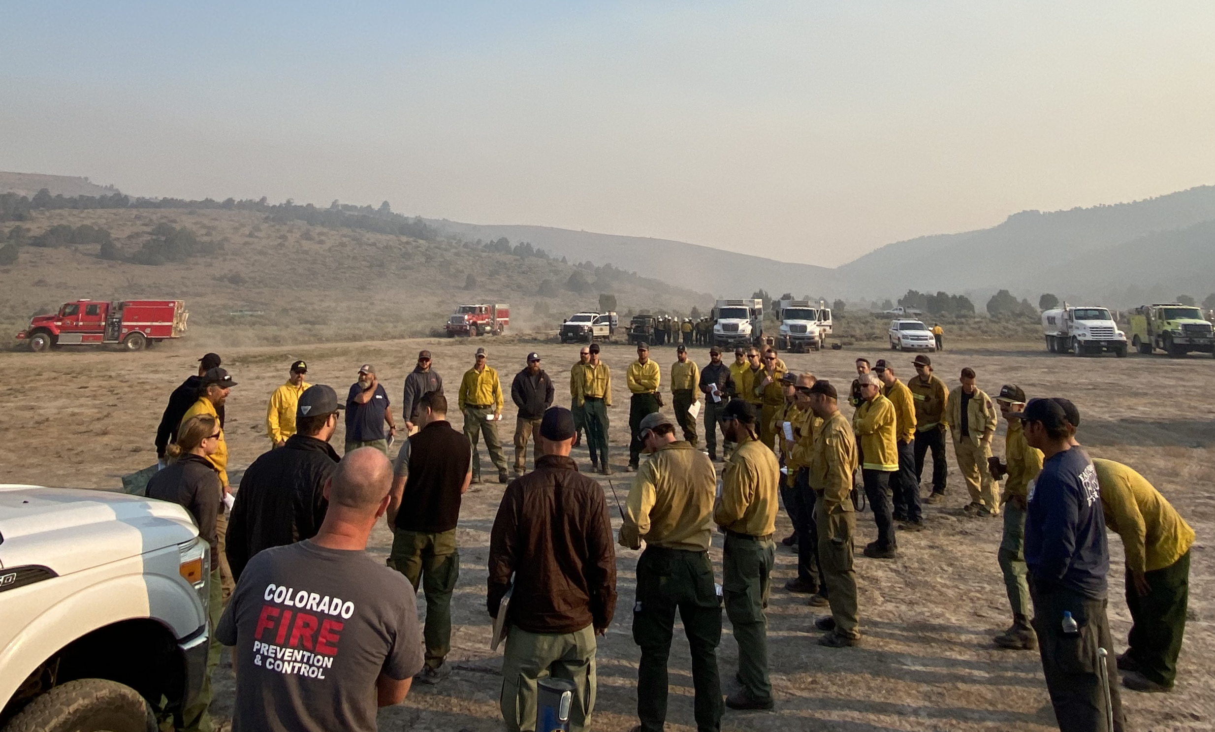
To improve the safety and effectiveness of first responders during tactical operations the CoE has worked to facilitate adoption of the Team Awareness Kit (TAK). TAK is a geospatial mapping engine, originally developed for the Android operating system, that facilitates tactical situational awareness, navigation, and data sharing. TAK is under continuous development by the TAK Product Center, a coalition of U.S. Department of Defense programs and other federal agencies. TAK employs a “government off-the-shelf” model, ![Crew using ATAK]() which stipulates that any new features developed for TAK be provided back to the government, thus ensuring that all government TAK users have free access to the software. TAK-Civ, a demilitarized version of TAK, has been open sourced by the TAK Product Center and can be freely downloaded for Android and iOS devices.
which stipulates that any new features developed for TAK be provided back to the government, thus ensuring that all government TAK users have free access to the software. TAK-Civ, a demilitarized version of TAK, has been open sourced by the TAK Product Center and can be freely downloaded for Android and iOS devices.
While the Android version of TAK, known as ATAK, is the most mature version of TAK, apps also exist for viewing the TAK common operating picture via Windows (WinTAK), iOS (iTAK), virtual reality (VTAK) and the web (webTAK). Several of these TAK programs include plugin architectures which allow developers to add additional features and capabilities by authoring a plugin, rather than modifying code in the base application. Several plugins are pertinent to first responders—such as plugins that integrate radio systems, allowing the app to function in areas that lack cellular service, and plugins that synchronize official geospatial data regarding disasters across all TAK devices.
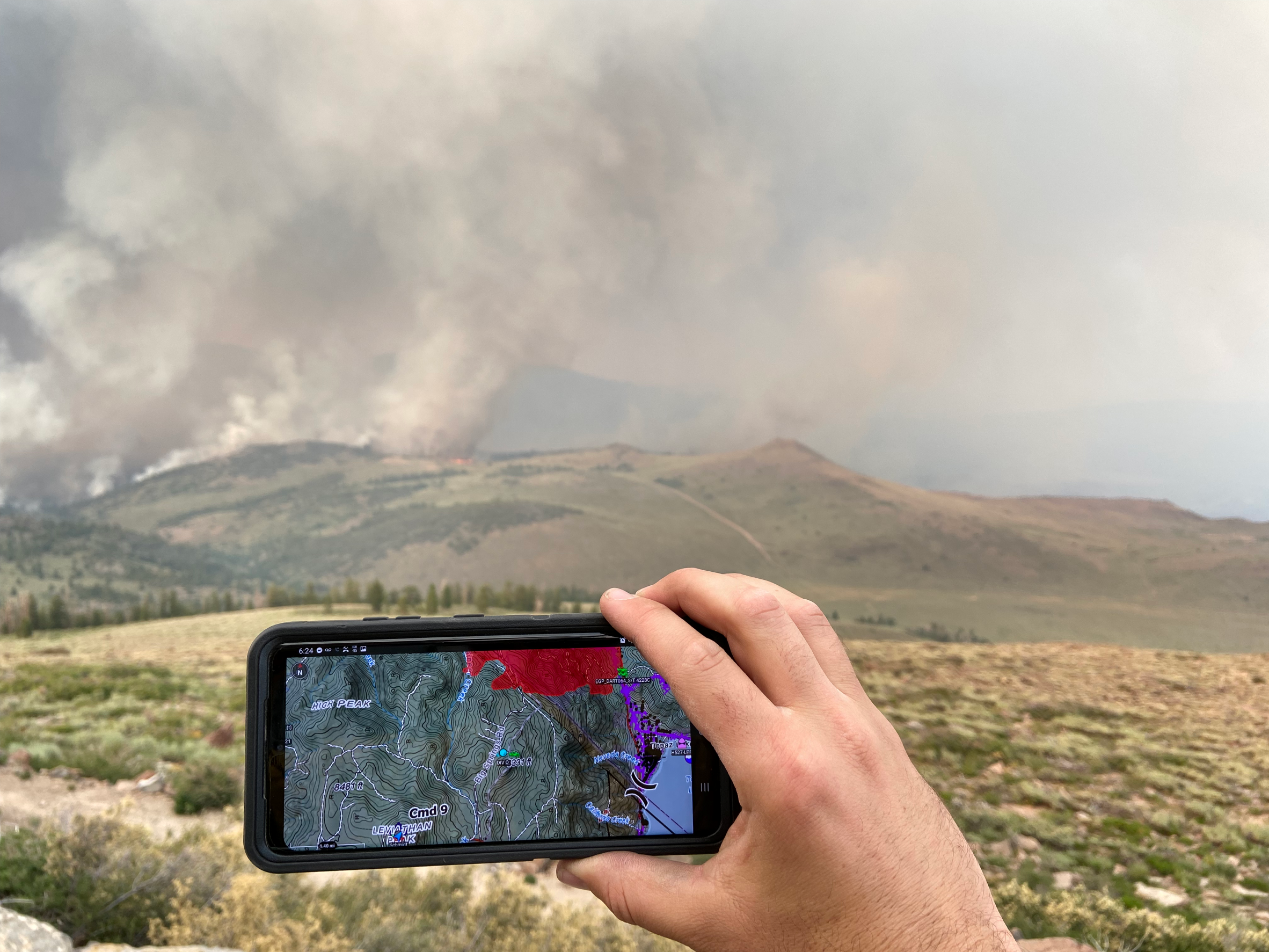
The CoE utilizes TAK with a cloud-based server when Internet connectivity is available and is evaluating commercially available radios and deployable networks that enable the TAK app to function without a full Internet connection. When disconnected from the Internet, TAK can either transmit basic data (such as position reports) directly between radios, or utilize a small server physically deployed at the incident to relay maps and more complex data. ![Popular Science Best of What's New 2020]() The CoE has deployed TAK at public safety incidents in Colorado since 2018, as well as with Colorado Division of Fire Prevention and Control fire crews, to gain an operational perspective on the system.
The CoE has deployed TAK at public safety incidents in Colorado since 2018, as well as with Colorado Division of Fire Prevention and Control fire crews, to gain an operational perspective on the system.
In 2020 the Team Awareness Kit was awarded as part of the "Best of What's New" from Popular Science for its use in disaster response by the CoE and other agencies, and its open sourcing by the TAK Product Center. The CoE will continue to foster development and deployment of TAK through collaboration with military and civilian TAK stakeholders and partner public safety agencies.
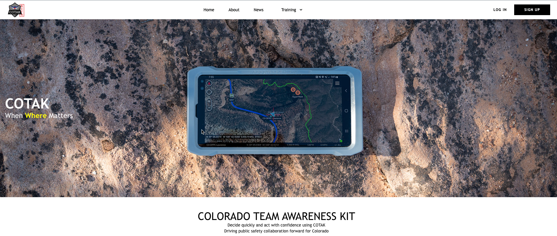 The Colorado Team Awareness Kit (COTAK) has launched at cotak.gov and is in beta for testing and use by first responders. COTAK is freely available to all public safety agencies in Colorado, and provides up-to-the-second location services to first responders using the Team Awareness Kit or TAK apps. The United States Department of Defense originally developed TAK to provide situational awareness to military forces. The CoE has conducted research into TAK for use in public safety operations since 2016, and has been developing COTAK as an operational system since 2022.
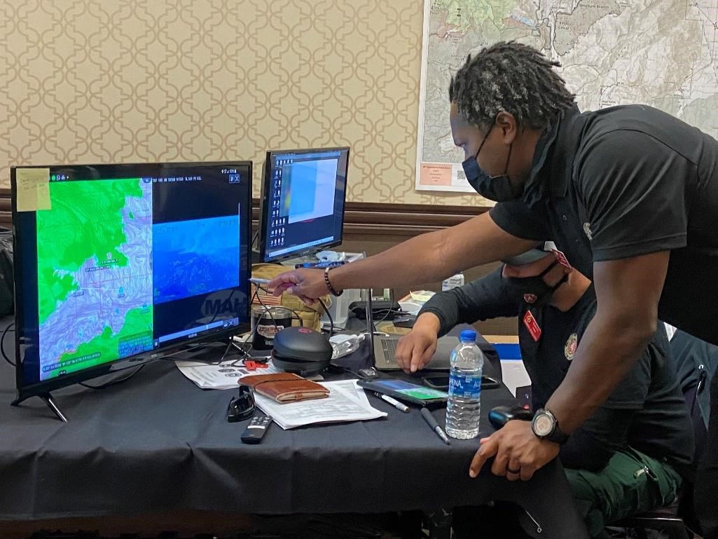
 However, when first responders are operationally engaged in disaster response, in other words are "boots on the ground," their options for maintaining situational awareness are far more limited. Typically they rely on voice radios, aka walkie talkies, to exchange information with other first responders. They may have a preplan or topographic map of the disaster area, which on rare occasions will be updated with content related to the ongoing disaster.
 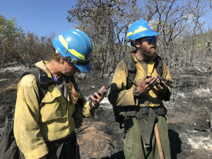 which stipulates that any new features developed for TAK be provided back to the government, thus ensuring that all government TAK users have free access to the software. TAK-Civ, a demilitarized version of TAK, has been open sourced by the TAK Product Center and can be freely downloaded for